Scaling Restoration with the Macro & Geospatial Lens
Seeing the Whole Picture: Scaling Restoration with the Macro & Geospatial Lens Understanding the Scale of the Challenge
Ecosystem degradation is not an isolated problem—it’s a planetary dilemma. With over 2 billion hectares of land requiring restoration, decision-makers face a fundamental challenge: Where should we focus efforts for the highest impact? How do we measure, quantify, and track ecosystem change at such a vast scale?
At Dendra, we approach restoration combining multiple lenses to creating a layered data strategy, using the macro lens and geospatial lens to understand landscapes at both regional and refined-scale levels. These two perspectives work together to quantify the scale of the challenge, prioritize key intervention areas, and ensure restoration projects operate with precision at every stage.
Let's begin with the Macro Lens: Seeing the Big Picture
A regional, millions of hectares, scale approach is essential for understanding long-term ecological trends. The macro lens offers a bird’s-eye view of ecosystem transformation, relying on:
- Historical satellite imagery to analyze vegetation shifts, watercourse changes, and impacts on different environments over long periods of time
- Large-scale datasets that can be used to track things like mangrove extents, tidal movements, and land cover change.
- Brought together for temporal analysis to detect ecosystem degradation trends, identify trends, and plan proactive interventions.
This approach allows us to combine spatial, temporal and spectral changes over time, to predict and pinpoint broad zones of ecological concern before zooming in with other lenses for targeted action.
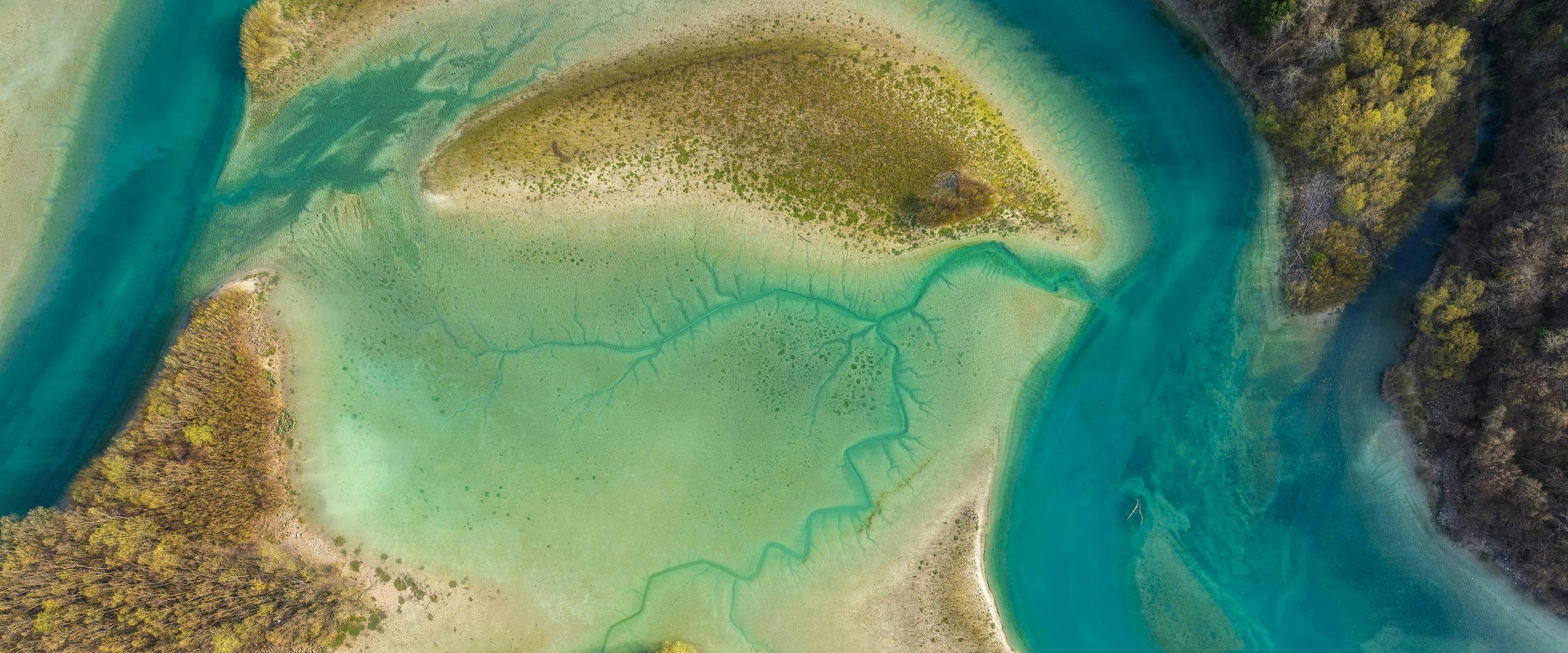
For example, in mangrove restoration, historical satellite data can reveal how coastal vegetation has changed over the past 20 years. This dataset, combined with others, are of great help to predict and identify areas with the highest restoration potential, ensuring that resources are deployed effectively.
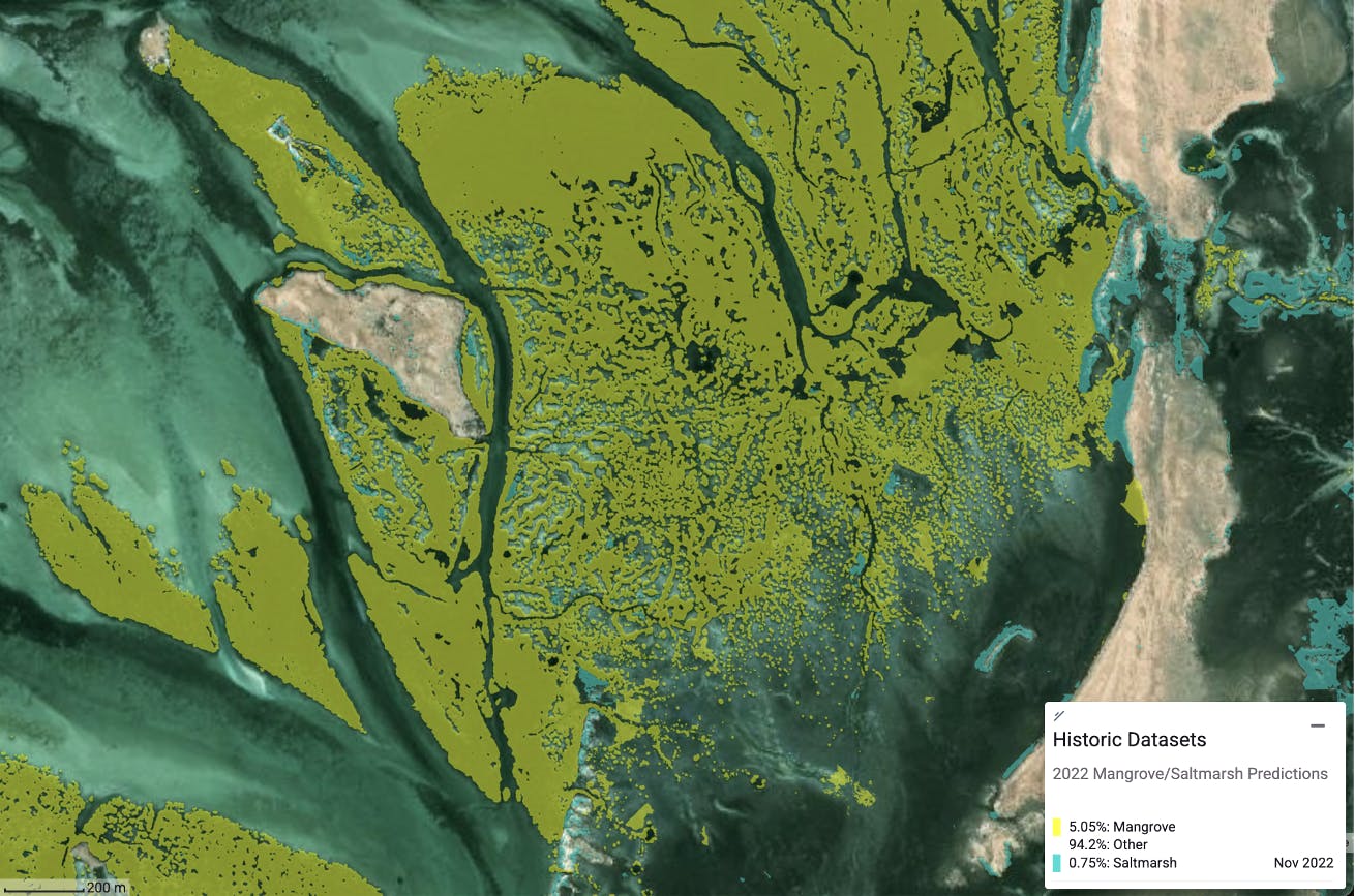
Image 1. Model predicting Mangrove & Saltmarsh extents using historical datasets
Leading into the Geospatial Lens: Turning Data into Actionable Insights
Once the macro lens establishes the broader restoration landscape, the geospatial lens allows us to drill down into the details, turning large-scale monitoring into site-specific action plans.
Through high-resolution imagery data collection from aircrafts, drones and satellites, we use geospatial insights to:
- Classify land cover—mapping terrain types such as bare ground, water, shrubs, and trees.
- Quantify vegetation health—leveraging multispectral imaging to create models such as NDVI (Normalized Difference Vegetation Index) and SAVI (Soil Adjusted Vegetation Index) to assess ecosystem vitality.
- Model erosion risks—using LiDAR data and topographical modeling to highlight erosion extent and severity.
This transition from broad-scale observation to fine-scale analysis is key to prioritizing interventions efficiently. In mining rehabilitation, for instance, geospatial indices allow us to rank disturbed areas based on their ecological recovery potential, ensuring that revegetation efforts are strategically placed for maximum impact.
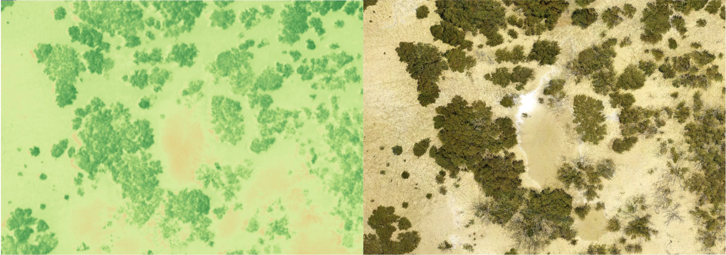
Image 2. SAVI & Ultra-High-Res colour imagery side by side
From Measurement to Impact
By integrating macro and geospatial lenses, we bridge the gap between ecosystem-scale understanding and localized restoration action. Seeing the bigger picture isn’t just about observation—it’s about guiding restoration teams toward the most effective decisions.
With this approach, land managers, policymakers, and environmental specialists can:
- Quantify the scale of degradation before committing resources.
- Target high-impact intervention areas to optimize restoration success.
- Monitor progress dynamically, ensuring long-term ecological stability.
Restoration is a data-driven journey, and through macro and geospatial analysis, we ensure every decision is backed by precision.
Let's reimagine environmental management together.
Book a demo today and discover how Dendra's advanced data & AI insights can guide better environmental management practices for your project.