Erosion management and reporting reimagined: Dendra Erosion
A way to more effectively manage mine site erosion
In Australian mining, environmental managers face the constant challenge of monitoring, managing and reporting on erosion—a key factor in safe and sustainable landform rehabilitation. Today, we’re excited to introduce a solution that transforms these challenges into opportunities with Dendra Erosion.
Developed with the insights and feedback from our customers, Dendra Erosion was created from a need for a more efficient, safe, and comprehensive way to handle erosion on rehab. Traditional methods often require extensive ground surveys, dealing with permits or having contractors on site and managing personnel logistics that can disrupt mine operations. Our team saw an opportunity to innovate through technology.
Harnessing the power of LiDAR
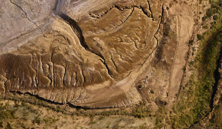
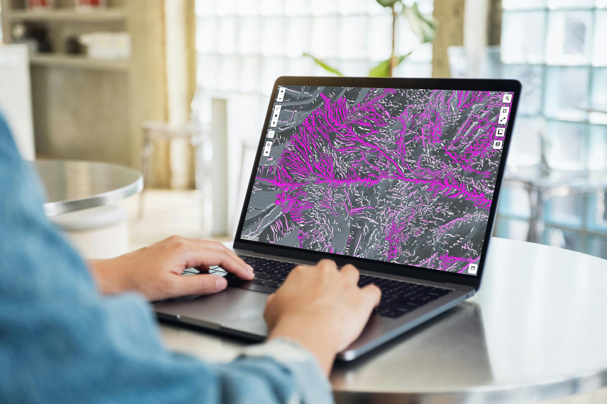
Our previous approach combined high resolution RGB imagery paired with Digital Elevation Models to identify and quantify erosion features such as rills and gullies to understand their lengths and widths over large areas. We have now taken a major step forward, our erosion insights are now based on LiDAR technology. Dendra Erosion offers a way to acquire comprehensive erosion insights without the need for boots on ground. The process is simplicity itself, send over some LiDAR data or use one of our approved partners to capture it for you, then we process this data to reveal erosion features which we display using our erosion heatmaps feature, showing not just the current state of erosion but also their change over time.
Benefits of LiDAR based erosion management
Through these visual insights, you can see the deeper story your land tells—where the problem areas are most severe, how they have changed, and where to focus your efforts. Using LiDAR, we have evolved our product from capturing lengths and widths of erosion features to include volumetric data and feature depths over time. Taking approaches beyond just monitoring, into proactive management and facilitating reporting. Complemented by our in-built tooling enabling specific areas of interest to be isolated, to strategize and prioritize your actions, ensuring that your interventions are as effective as possible, and transparently tracked within a central repository.
With Dendra Erosion, you’re enhancing data quality, improving compliance reporting and simplifying the informed decision making process. The breadth of coverage ensures no hidden erosion escapes your notice, even beneath dense vegetation. And with results delivered within just 10 days of receiving LiDAR data, your actions can be quick and justified, significantly reducing the risks associated with erosion risk prone areas. The journey of Dendra Erosion is a testament to our commitment to environmental stewardship and our belief in empowering managers with the tools they need to succeed.
We invite you to join us in this next step towards more effective and efficient land rehabilitation. For more information on Dendra Erosion and how it can help you transform your approach to erosion management, reach out for a demo.