Combining the precision of on-the-ground surveys with the scalability of AI-powered remote sensing
In this video
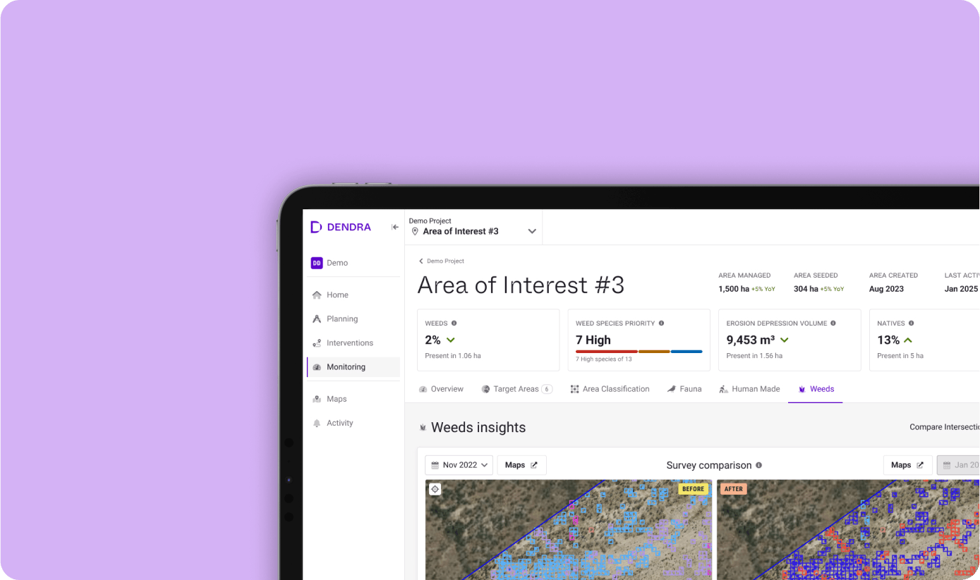
Explore how Dendra bridges the gap between field ecology and spatial monitoring, combining the precision of on-the-ground surveys with the scalability of AI-powered remote sensing. Learn how field data validates and trains AI models, enabling species and habitat identification at scale, while ensuring accuracy and reliability.
Watch as we demonstrate how geolocated survey features feed into machine learning workflows to distinguish and detect species across vast landscapes. See how Dendra’s ground-to-cloud approach connects specific observations to broader habitat insights, delivering powerful tools for environmental management.
Ready to scale your field ecology with precision and confidence?
Book a demo today and see how Dendra’s data and AI transform environmental monitoring at every level.
Product demo library