3 mins
Monitor and Report on your project
In this video
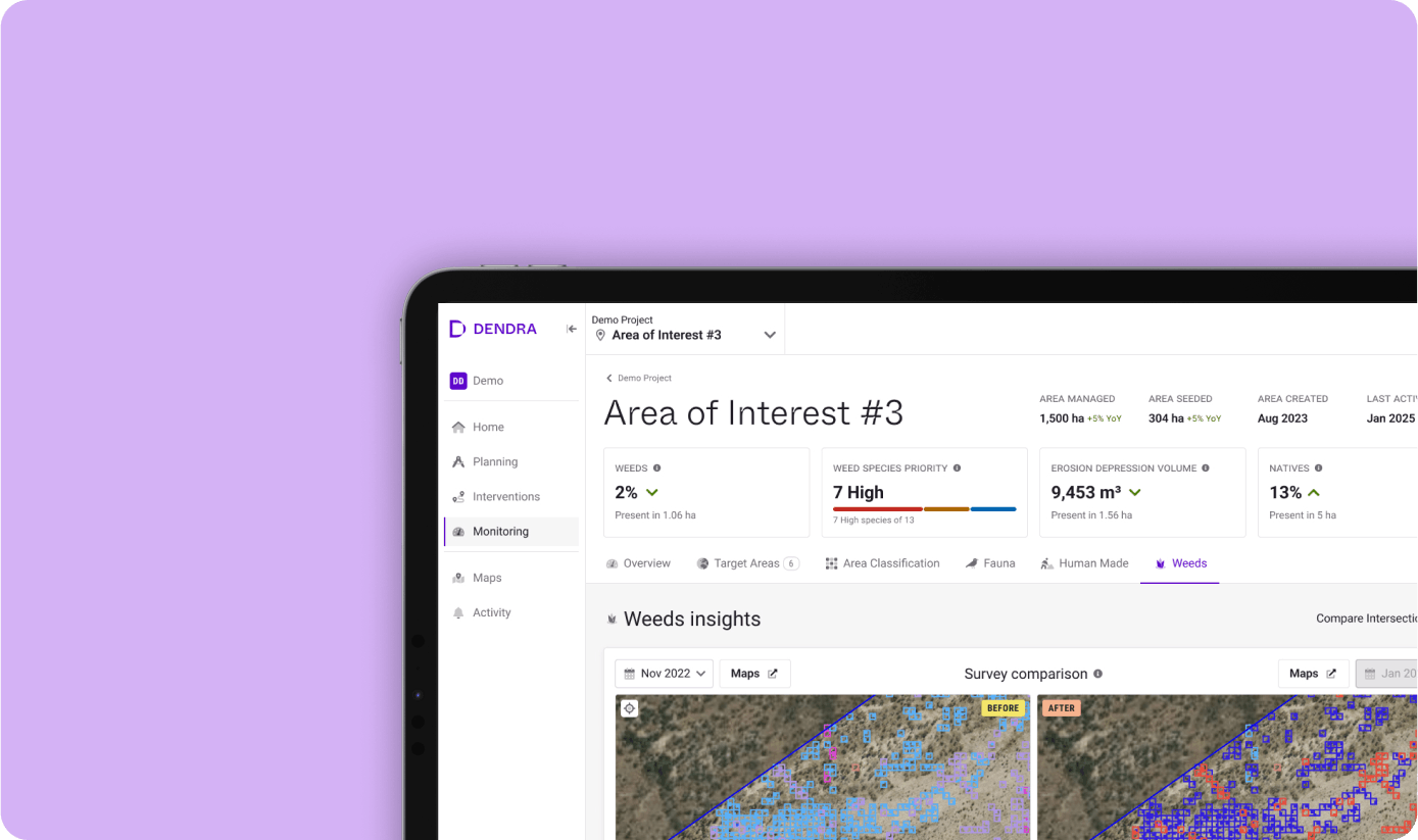
Discover how Dendra’s Monitoring App transforms ecosystem restoration by providing detailed insights to track progress over time. Learn how layering historical and current data reveals trends, predicts outcomes, and ensures measurable impact.
Watch as we demonstrate features like interactive dashboards and side-by-side data comparisons that simplify monitoring and transparent reporting. See how the Monitoring app helps identify areas needing intervention, monitor long-term ecosystem health, and share compelling restoration narratives with stakeholders.
Ready to track ecosystem changes with clarity and precision?
Book a demo today and explore how Dendra empowers better decisions and collaborative environmental management.
Product demo library
3 mins
Product demo
Dendra Erosion
Pinpoint erosion features and trends faster and more accurately than ever before.
2 mins
Product demo
See our AI in action identifying 100s of plant species in a matter of seconds.
Compare historical and current data to track any trends, identifying where the restoration project has been most effective.
3 mins
Product demo
Area Classification and Vegetation Height Classification
Classify land cover and their heights, helping you monitor, manage, and restore ecosystems at scale with precision.
3 mins
Product demo
Native Species
Ecology-powered AI, enabling the monitoring of native flora distribution, abundance and interactions across large landscapes.
3 mins
Product demo
Bridging Field and Spatial Ecology
integrate field ecology with spatial ecology to deliver comprehensive habitat-level understanding
3 mins
Product demo
Combining the precision of on-the-ground surveys with the scalability of AI-powered remote sensing
Upscaling Field Ecology with AI-Powered Insights
3 mins
Product demo
Mangrove Extent Model
Precise tracking of large-scale mangrove ecosystem coverage over satellite imagery
3 mins
Product demo
Weed Management
Map infestations and report on their control over time across large areas